Introduction
THIRD PLACE FOR WILDLIFE
Our Mission
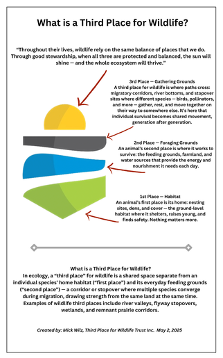
Our mission is simple: to create a true “third place” where wildlife, people, and community can thrive together.
“When conservation and community come together, the land becomes a gathering place — not just for wildlife, but for people, stories, memory, and meaning. That’s when something special happens — when preservation becomes legacy.”
— Mick
Third Place for Wildlife Trust, Inc. is a 501(c)(3) nonprofit dedicated to conservation, stewardship, and community connection in the Whitewater Valley of southeastern Indiana. Rooted in history, habitat, art, education, and working farmland, we are building what we believe will become a landmark destination for Franklin County — and a model for how communities can honor their past while investing in the future of the natural world.
OUR WORK IS CENTERED AROUND TWO SIGNATURE INITIATIVES
Connected by the Historic Whitewater Canal Trail, these two projects sit within an easy one-mile walk of each other along the scenic West Fork of the Whitewater River. The canal and its towpath are listed on the National Register of Historic Places — a living corridor where history, science, art, and community come together, and where a new chapter for Franklin County is beginning.
The Charley & Edie Harper Art & Bird Migration Center
Mick and Jenny Wilz, founders of Third Place for Wildlife Trust, Inc., are working in partnership with Charley Harper Art Studio LLC, under the project oversight of the Franklin County Arts Council, to create a permanent outdoor art and bird migration center in Franklin County, Indiana. Inspired by the surrounding landscape and the enduring connection between art and the natural world, the Center is envisioned as a place of discovery, reflection, and learning.
This collaboration ensures that the Center will honor the spirit and legacy of Charley and Edie Harper, whose work is celebrated in museums and exhibitions around the world. Together, the partners are committed to creating a world-class destination where conservation, education, and design meet in a meaningful and lasting way.
The Research and Discovery Park at Boundary Hill
A 35-acre base camp for ecological research, farmland conservation, and river protection along one of Indiana’s most under-conserved waterways — home to the Amos Butler Family Legacy Trail and rooted in over two centuries of layered history.
The Full Story:
The Research and Discovery Park at Boundary Hill
Featuring the Amos Butler Family Legacy Trail
The Amos Butler Family Legacy Trail honors three generations of the Butler family whose lives and work shaped both Brookville and Indiana’s natural history. Amos Butler, a founding father of Brookville in the early 19th century, helped establish the community along the Whitewater River. His son, William Butler, carried the family’s ties to the community forward, and decades later, William’s son — Amos W. Butler — became one of Indiana’s most respected naturalists and a pioneer in systematic bird study. His landmark work, Birds of Indiana, was rooted in field observations from southeastern Indiana river valleys, including the Whitewater — one of the state’s least-protected river systems today.
This trail connects settlement and science — linking Brookville’s founding story with modern ecological research, history with habitat, and community with conservation.
About Boundary Hill
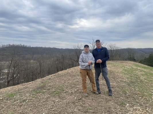
Boundary Hill, located just two miles west of Brookville, may appear modest in size at 35 acres — but it serves as the starting point and base camp for a far larger conservation vision. The surrounding landscape includes nearly 1,000 acres accumulated by the Wilz family over the past 60 years across Franklin County. While portions of this land remain private, other parcels are expected to be incorporated into the Third Place for Wildlife Trust’s conservation efforts as donation and tax-advantaged giving opportunities become available — positioning the Research and Discovery Park as the anchor site for a landscape-scale research and conservation initiative spanning the Whitewater Valley.
As this park grows, it will serve as a hub for research and education — a place where farmers, river and watershed conservation groups, community residents, and students on field trips can learn firsthand why protecting this landscape matters. From hands-on ecological research to practical, farmer-focused training, the Research and Discovery Park is designed to bring together the people who live, work, and study along the Whitewater River in service of its long-term health.
Running directly through this hill is the western boundary line established by the Treaty of Greenville (1795), a pivotal agreement that opened much of present-day Ohio and southeastern Indiana to American settlement following the Northwest Indian War. In the years that followed, determination and engineering carved multiple routes through this natural barrier:
1825 — Harrison Pike, the first state road, was cut over the top
Late 1830s — The Whitewater Canal passed through a hand-cut notch in the southern slope
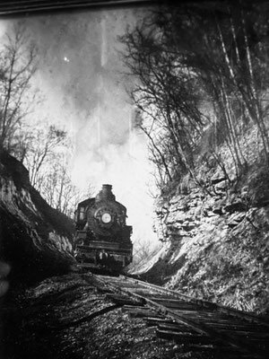
1850s — A central cut carried the railroad and telegraph lines westward
Early 1900s — U.S. 52 opened a modern highway corridor along the northern passage
Today, Boundary Hill is a layered timeline of movement — from treaty line to footpath, from canal to railroad to highway. Each generation reshaped the land in pursuit of what lay beyond: settlers on foot and horseback, canal boats moving freight and passengers, steam trains and telegraph lines carrying goods and information west, and eventually automobiles on U.S. 52. That same land, largely undisturbed along its river-bottom edge, now forms the ecological baseline for the studies described below.
This stretch of the Whitewater Valley carries ecological as well as historical weight. Boundary Hill sits along a key corridor of the Mississippi Flyway, one of North America’s major migratory bird routes, making it a critical stopover point for species traveling between breeding and wintering grounds each spring and fall. The area’s significance to bird life is not new: this same canal corridor is tied to one of American ornithology’s most sobering milestones — the last verified wild passenger pigeon shot in the wild, in Franklin County in 1902, now commemorated at the Whitewater Canal State Historic Site in Metamora. That history stands as a stark reminder of what is lost when habitat and migratory corridors go unprotected, and it underscores why the ongoing work at the Research and Discovery Park matters today.
In 2023, the Wilz family purchased Boundary Hill and launched what is now The Research and Discovery Park at Boundary Hill .A comprehensive ecological study is now underway, led by Dr. David Russell of the Avian Research and Education Institute, with field support from Miami University students gaining hands-on training in ecological and hydrological research. Dr. Russell’s current work focuses on moths, beetles, and bees — the pollinators and foundational species that sustain the native plant communities birds and other wildlife depend on. This baseline data, alongside documentation of the aquifers beneath the site that feed the West Fork Whitewater River, will serve as the scientific foundation for future conservation planning across the Whitewater Valley.
The river-bottom land at the heart of this project is also currently farmed, and protecting that agricultural use — not eliminating it — is central to our approach. A key outcome of this project is working directly with local farmers to reduce heavy erosion along the riverbank, promote best farming practices, and lower reliance on herbicides that damage the pollinator and aquatic systems this research is documenting. We see working farmland and functioning ecosystems as complementary, not competing, goals.
Our goal is fivefold: to protect the aquifers and river-bottom habitat that support clean water and resilient ecosystems along one of Indiana’s most under-conserved rivers; to safeguard the pollinators and foundational species that sustain the food web for resident and migratory birds along the Mississippi Flyway; to support local farmers through erosion control and reduced-herbicide practices; to build a lasting hub for research, farmer training, and community education along the Whitewater River; and to preserve this remarkable layered transportation history for future generations.
We invite you to explore, learn, and follow this journey — as we work to build a thoughtful, science-based future for water, wildlife, working lands, and conservation in Franklin County and the greater Whitewater Valley.